


Raven Voting District, Tazewell County, Virginia
About
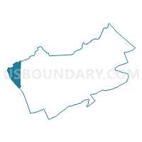
Outline

Summary
| Unique Area Identifier | 682648 |
| Name | Raven Voting District |
| County | Tazewell County |
| State | Virginia |
| Area (square miles) | 18.18 |
| Land Area (square miles) | 18.15 |
| Water Area (square miles) | 0.03 |
| % of Land Area | 99.82 |
| % of Water Area | 0.18 |
| Latitude of the Internal Point | 37.12448450 |
| Longtitude of the Internal Point | -81.85339900 |
Maps


Graphs
Select a template below for downloading or customizing gragh for Raven Voting District, Tazewell County, Virginia


Neighbors
Neighoring Voting District (by Name) Neighboring Voting District on the Map
- Cedar Bluff Voting District, Tazewell County, VA
- Contrary Voting District, Buchanan County, VA
- Jewell Ridge Voting District, Tazewell County, VA
- Richlands Voting District, Tazewell County, VA
- Swords Creek Voting District, Russell County, VA
- Whitewood Voting District, Buchanan County, VA
Top 10 Neighboring County Subdivision (by Population) Neighboring County Subdivision on the Map
- Northwestern district, Tazewell County, VA (8,882)
- Western district, Tazewell County, VA (8,841)
- New Garden district, Russell County, VA (7,347)
- Garden district, Buchanan County, VA (3,215)
Top 10 Neighboring Place (by Population) Neighboring Place on the Map
Top 10 Neighboring Unified School District (by Population) Neighboring Unified School District on the Map
- Tazewell County Public Schools, VA (45,078)
- Russell County Public Schools, VA (28,897)
- Buchanan County Public Schools, VA (24,098)
Top 10 Neighboring State Legislative District Lower Chamber (by Population) Neighboring State Legislative District Lower Chamber on the Map
Top 10 Neighboring State Legislative District Upper Chamber (by Population) Neighboring State Legislative District Upper Chamber on the Map
Top 10 Neighboring 111th Congressional District (by Population) Neighboring 111th Congressional District on the Map
Top 10 Neighboring Census Tract (by Population) Neighboring Census Tract on the Map
- Census Tract 301, Russell County, VA (4,672)
- Census Tract 106, Buchanan County, VA (4,623)
- Census Tract 210, Tazewell County, VA (4,234)
- Census Tract 205, Tazewell County, VA (3,152)
- Census Tract 209, Tazewell County, VA (2,079)
- Census Tract 105, Buchanan County, VA (1,516)
Top 10 Neighboring 5-Digit ZIP Code Tabulation Area (by Population) Neighboring 5-Digit ZIP Code Tabulation Area on the Map
- 24609, VA (7,630)
- 24641, VA (5,953)
- 24639, VA (3,533)
- 24649, VA (2,760)
- 24622, VA (1,028)
- 24657, VA (321)
- 24612, VA (229)